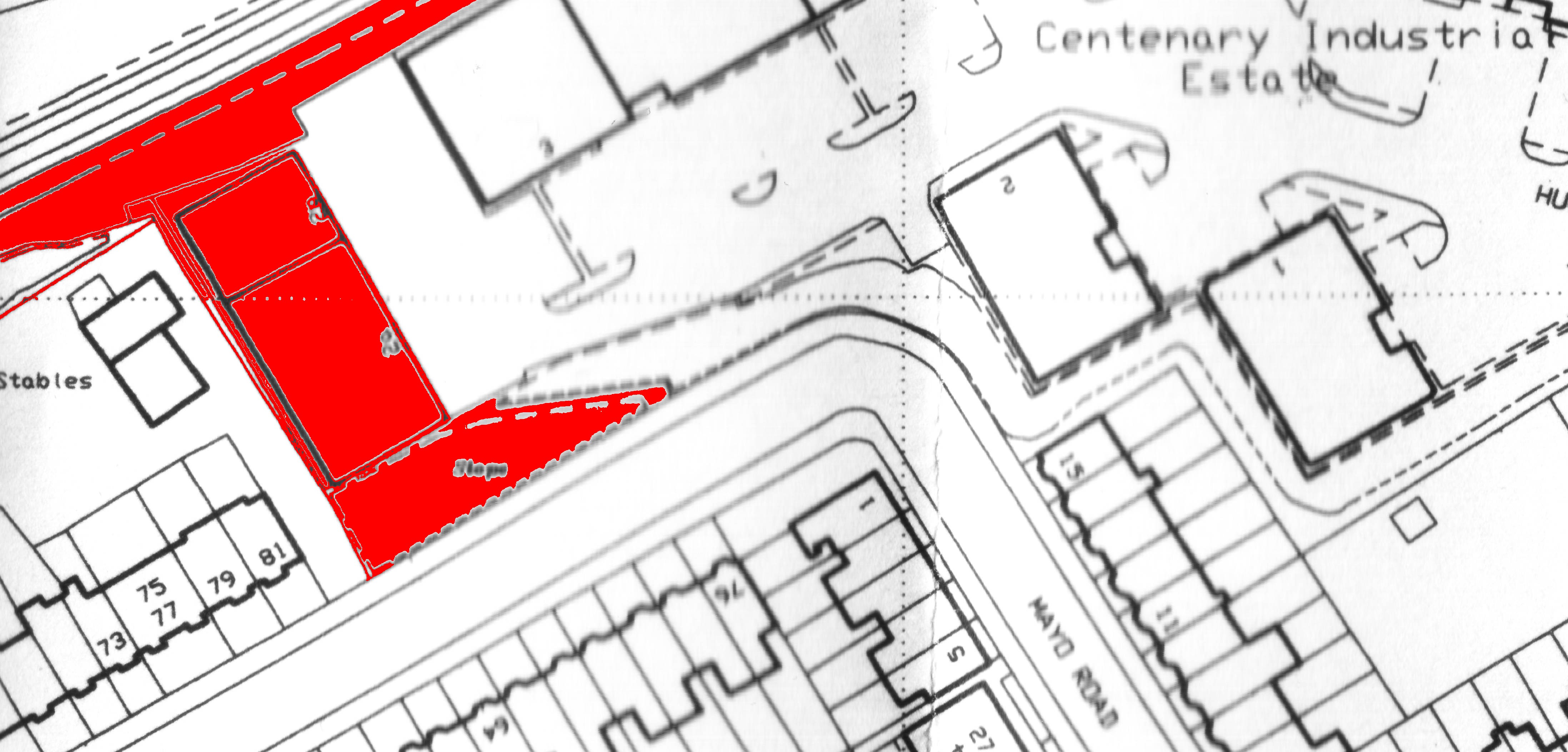
ABOVE: Units 2A and 2B on the Centenary
Industrial Estate, Hughes Road
in January 2008. It is hard to believe, looking at the Industrial Estate in the
present day, that any of the old railway workings ever existed. The signal box
for the Branch, Goods and Coal Yard stood at what is now the right hand end of
this block. The railway cutting, although not visible here, is just behind the
block and runs left to right. Note the looming framework of the Hollingdean
Waste Transfer Facility under construction in the background.
ABOVE:
This map shows the position of units 2A & 2B (shown in red) relative to Prince’s Road &
Mayo Road junction in order to make it easier to compare to the older map
location shown at the bottom of the page.
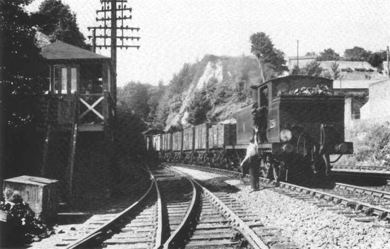
ABOVE: The Lewes Road Signal box is seen here
looking back along the cutting towards the tunnel under Ditchling Road, in 1954. The Box housed a
19 lever frame and dates from the time the Kemptown Branch was originally
opened. The “stilts” variety of signal box was quite popular in the Brighton
area, as similar structures could be seen at Lover’s Walk and the entrance to
Brighton Station’s Goods Yards, mentioned elsewhere. The locomotive is an E4
class (No. 32511) at the head of a daily goods train to Kemptown Station.
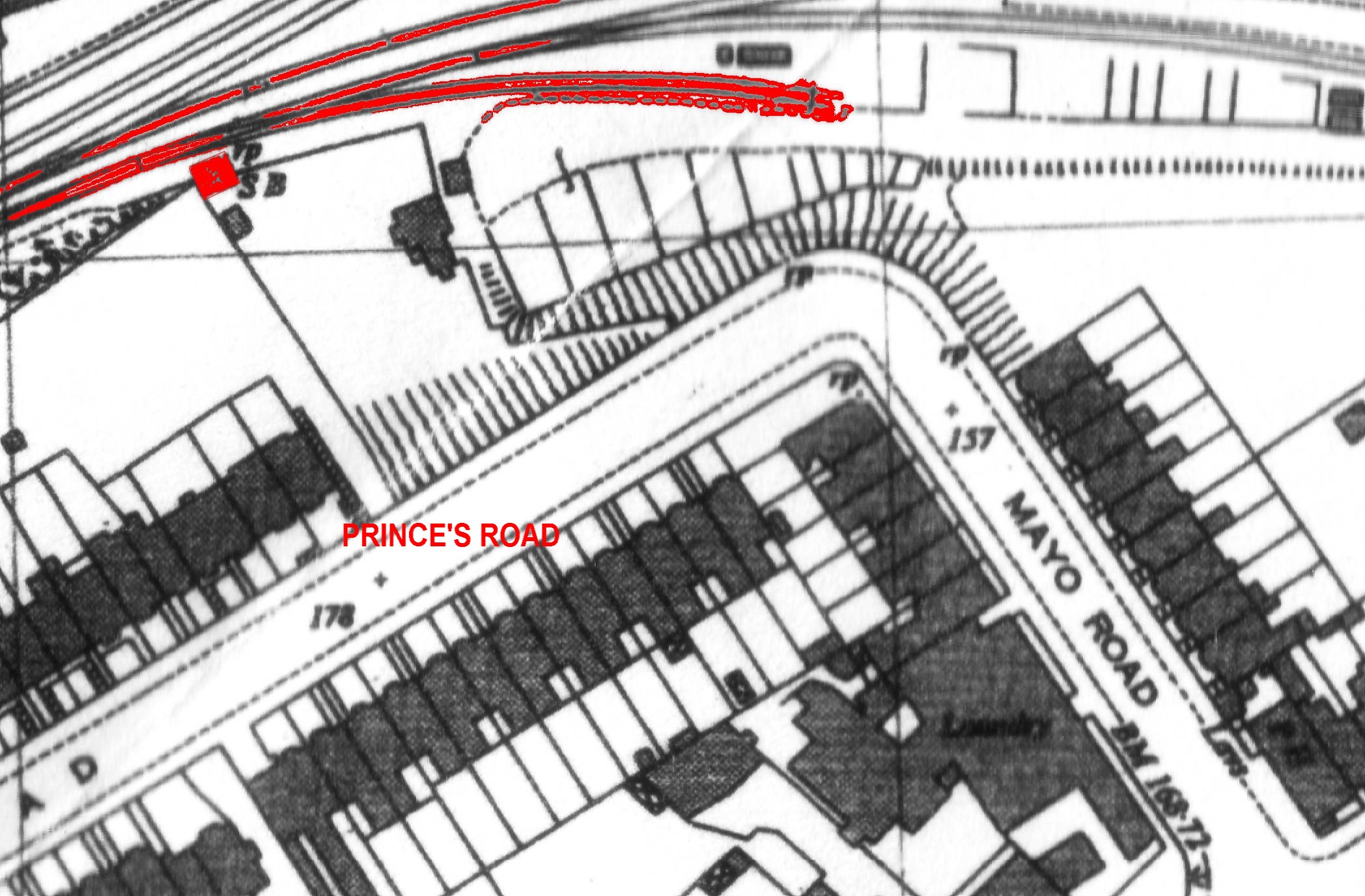
ABOVE:
This map shows (in red) positions of items in
the photo of the Signal Box shown above, relative to Mayo Road & Prince’s Road in order to
make it easier to compare to the modern map at the top of the page.