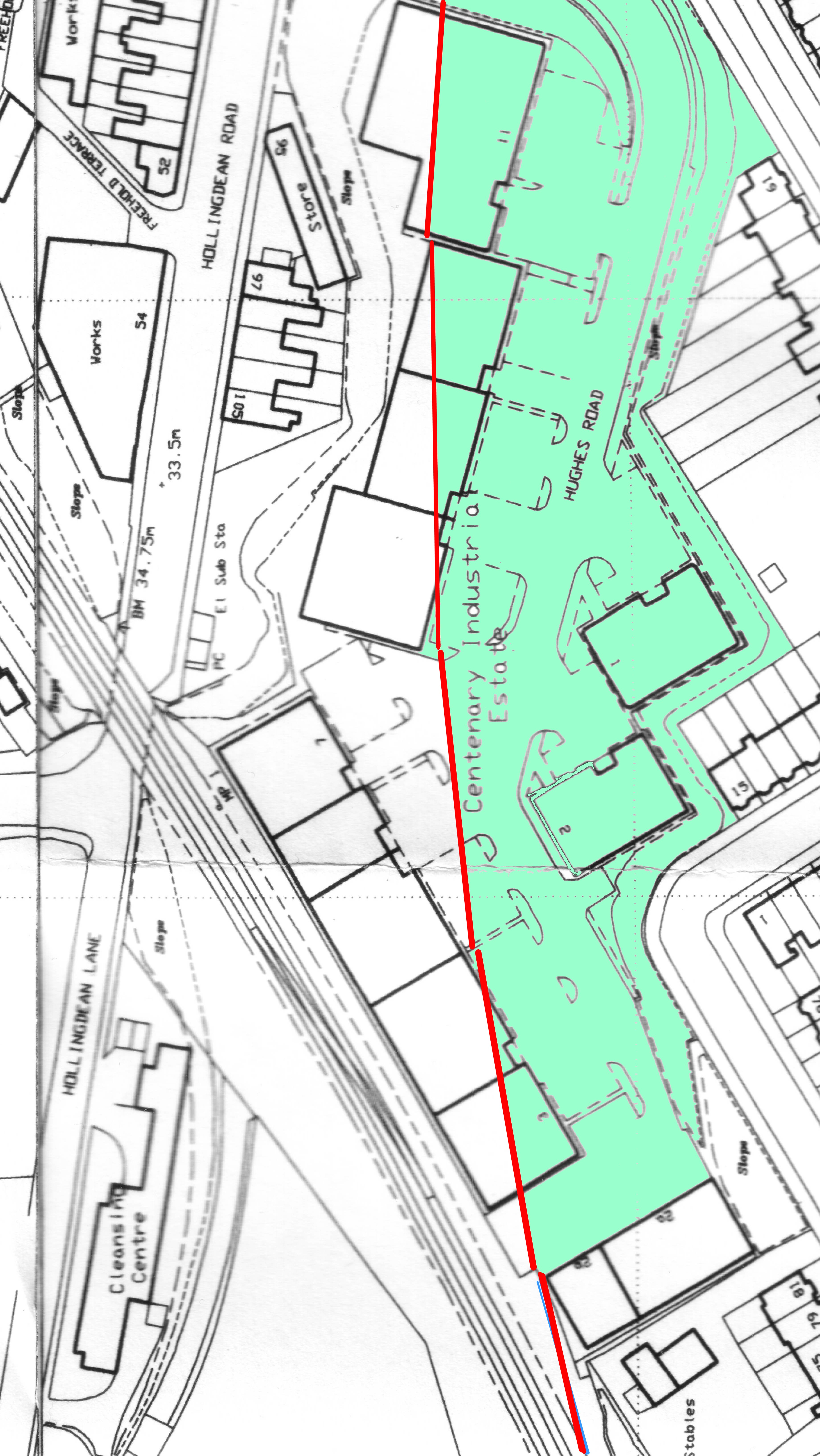
 Comments (1) for this picture
 | This
map shows the Centenary Industrial Estate in Hughes Road. The Lewes
Line branches off across the bottom left hand corner of the map whilst
the Kemp Town Branch route is shown in red. The blue area shows the
extent of the Coal Yard and Sidings compared to the present day. Map by O/S Publications, for illustration and personal research purposes only. By GHOST TRAINS - 8/5/2008 8:40 PM |
