 Comments (1) for this picture
 | A
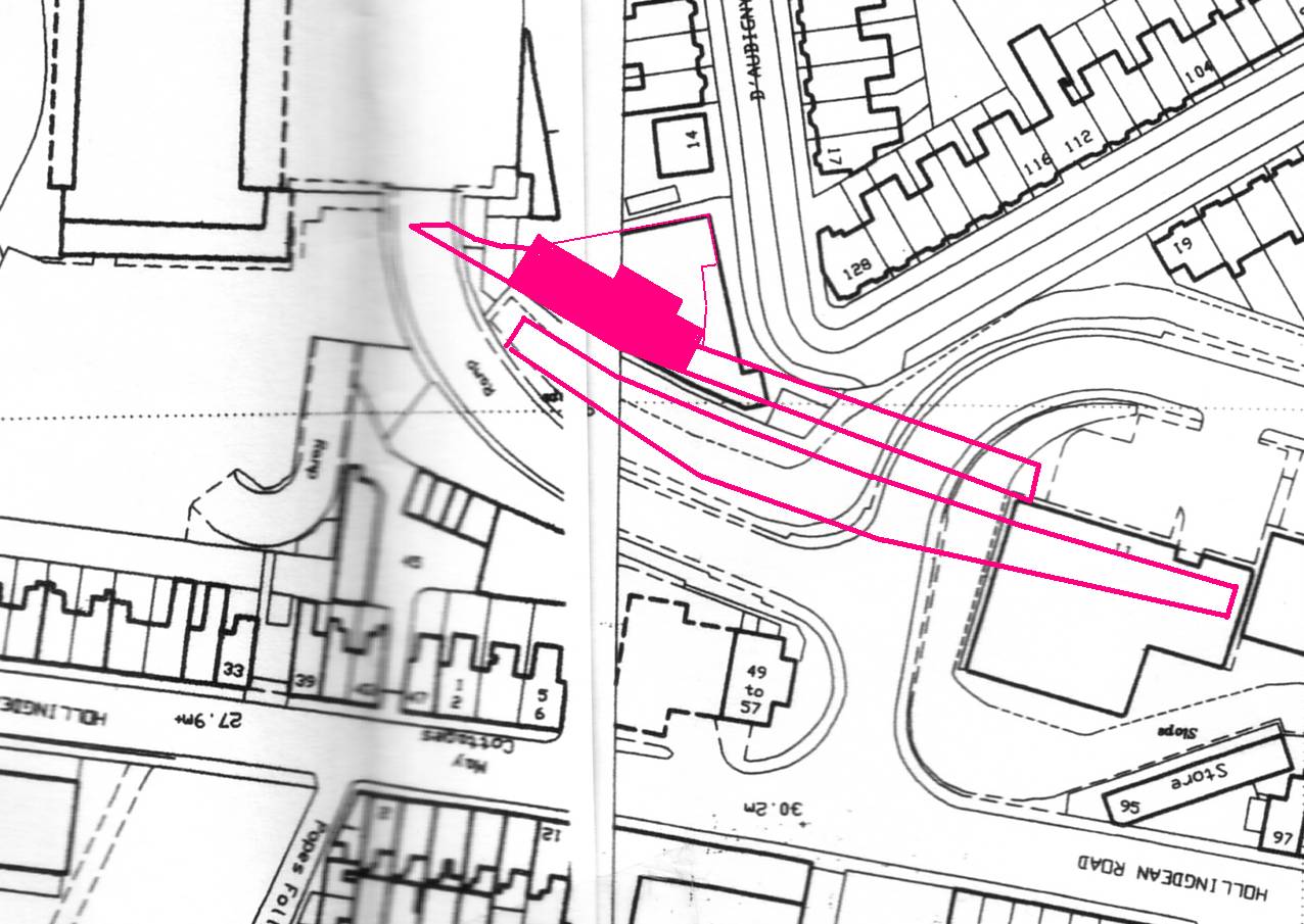
modern day map showing the entrance to Hughes Road and the Centenary
Industrial Estate.The elbow of D’Aubigny Road and Richmond Road can be
seen top right, Hollingdean Road runs along the bottom of the picture.
If you were to be standing on the pavement at the bottom of the mound
looking up the ramp towards Sainsburys then you would be looking along
the path of the old viaduct. Map by O/S Publications |
