 Comments (1) for this picture
 | This
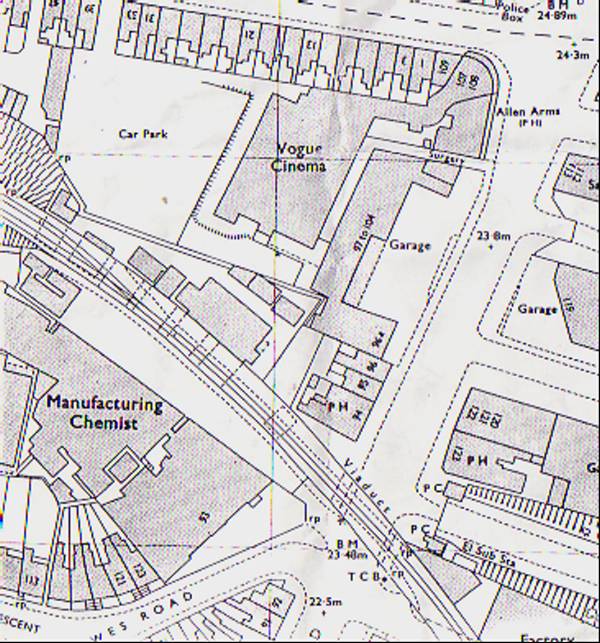
map shows the viaduct and surrounding structures in about 1935 and
shows the whole area that is encompassed by Sainsburys and the Vogue
Gyratory in the present day. The central span and western piers are all
clearly visible along the viaduct’s diagonal path (bottom left). The
manufacturing chemist referred to is Cox’s Pill Factory (more of which
later). The Allen Arms Pub (top right) still exists today under the
name of “The Hub” and rather than being on the corner of Lewes Road and
Hollingdean Road, it now sits precariously on an island in the middle
of the Vogue Gyratory, the junction having been moved onto the site
covered by the Vogue Cinema (pictured on next page) on this map, hence
the Vogue Gyratory. O/S Publications / Estate Publications By GHOST TRAINS - 8/5/2008 7:37 PM |
