In the late 1820’s, Thomas Read Kemp, one of the Lords of the Manor of Brighton, developed an estate of large houses on land he owned on the East Cliff, east of the main town centre. This development became known as Kemp’s Town after its developer.
Accompanied by the spread of smaller dwellings and shops towards the main town, this area catered for a large population centre but was poorly served by any established means of public transportation.
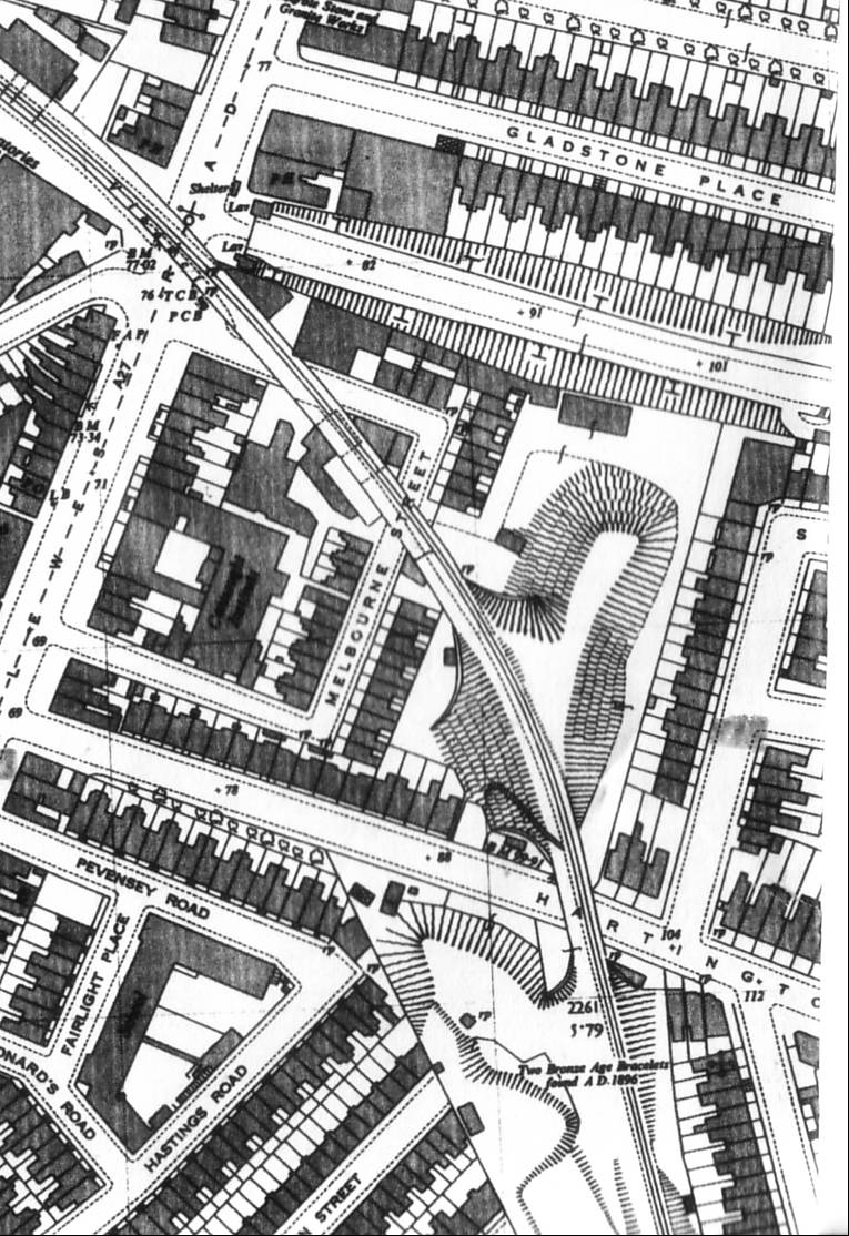
In 1864, the LBSCR obtained permission to build a branch line serving this part of the town and so, on the 2nd August 1869, The Kemptown Railway was born.
The Kemptown railway crossed Brighton due south-east in a wide arc between Hollingdean and what is now the Royal Sussex County Hospital.
For such a small branch line, there was a huge amount of civil engineering employed in the route across Brighton.
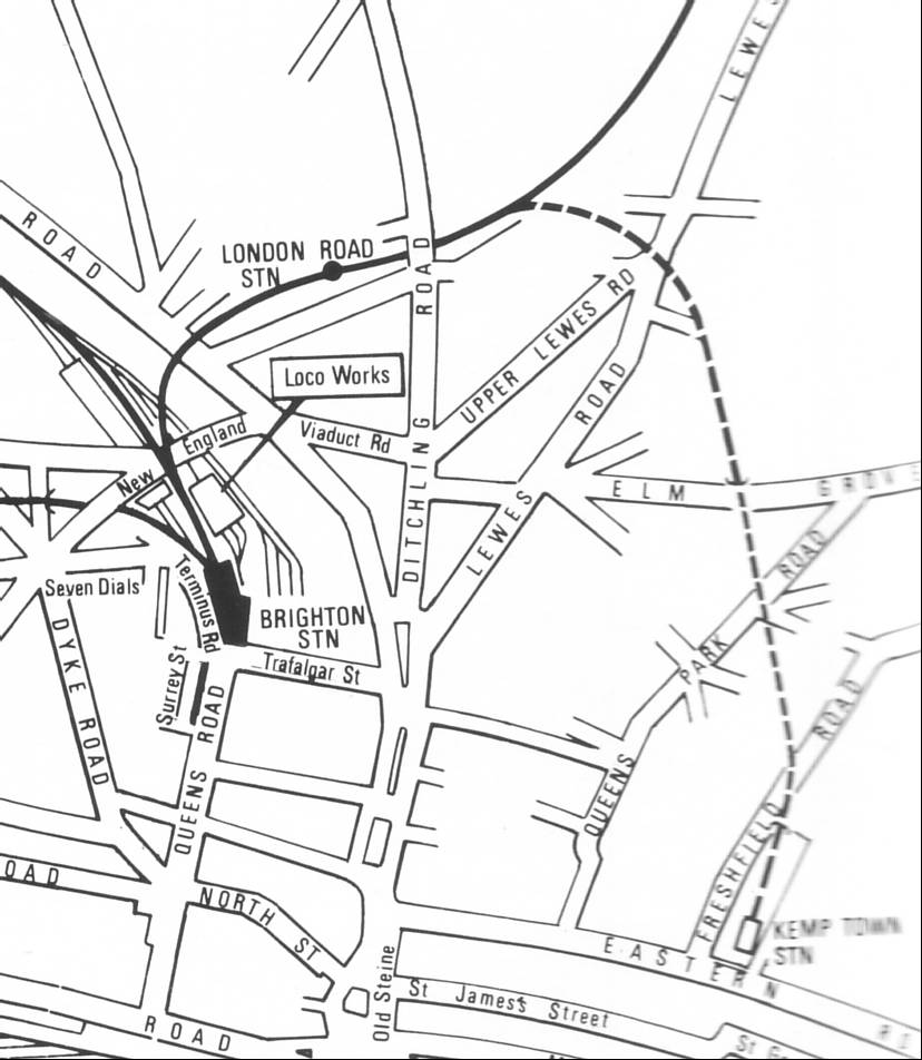
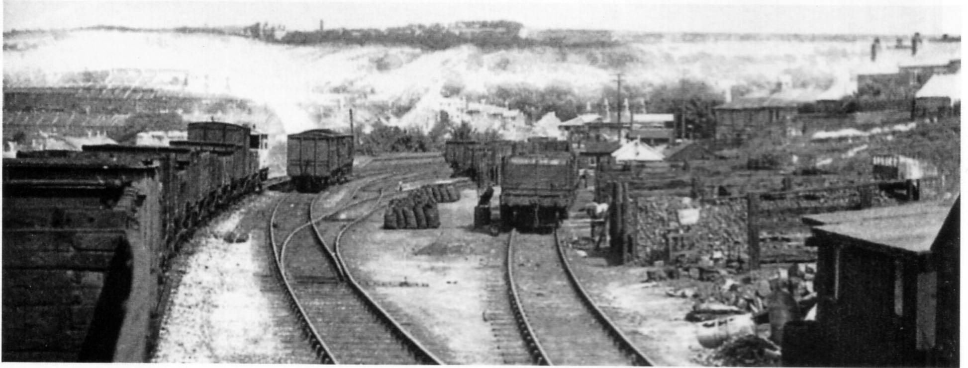
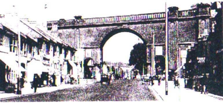
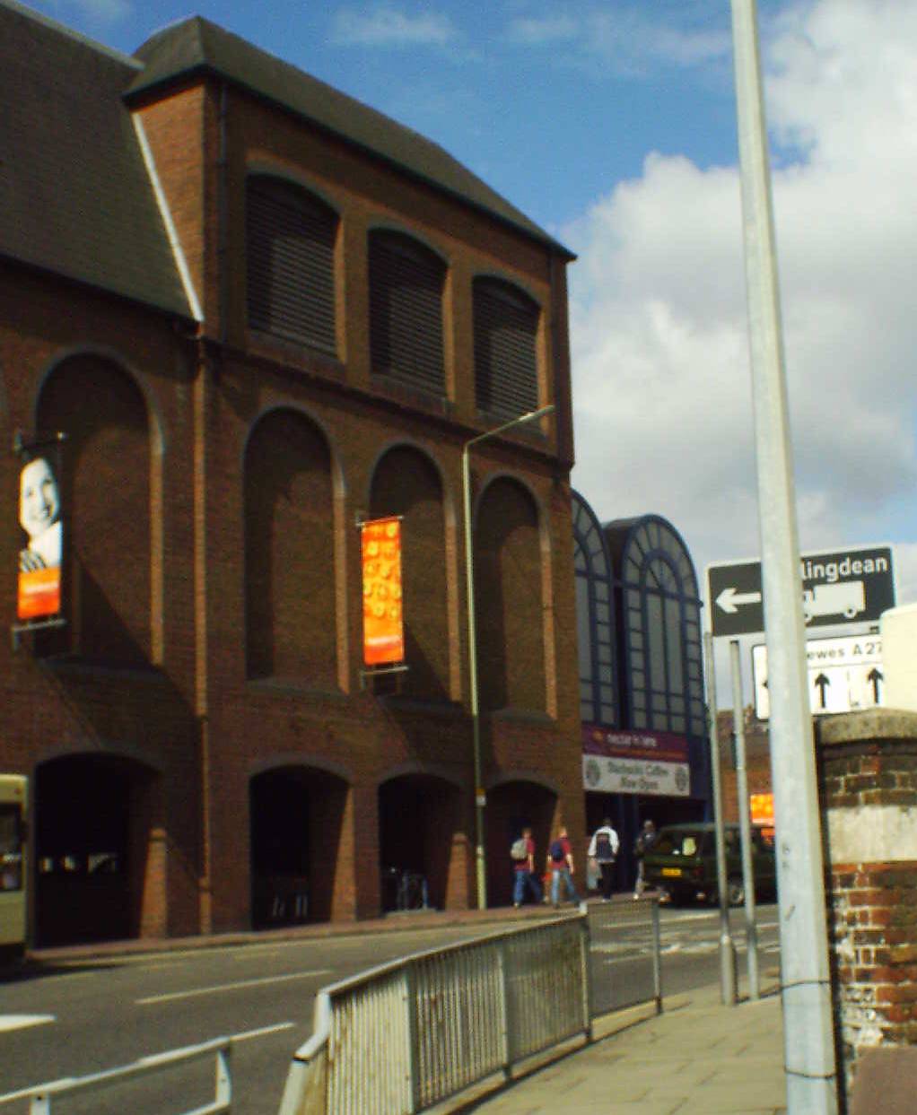
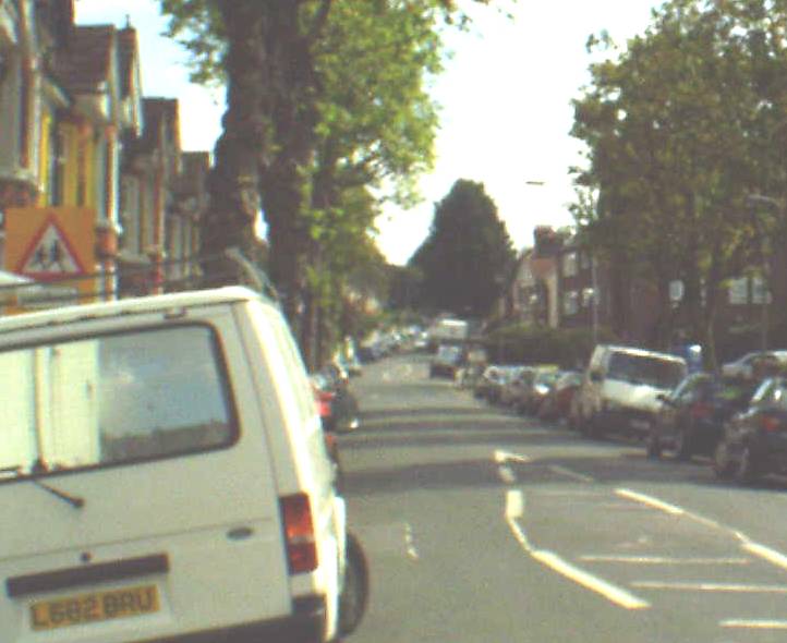
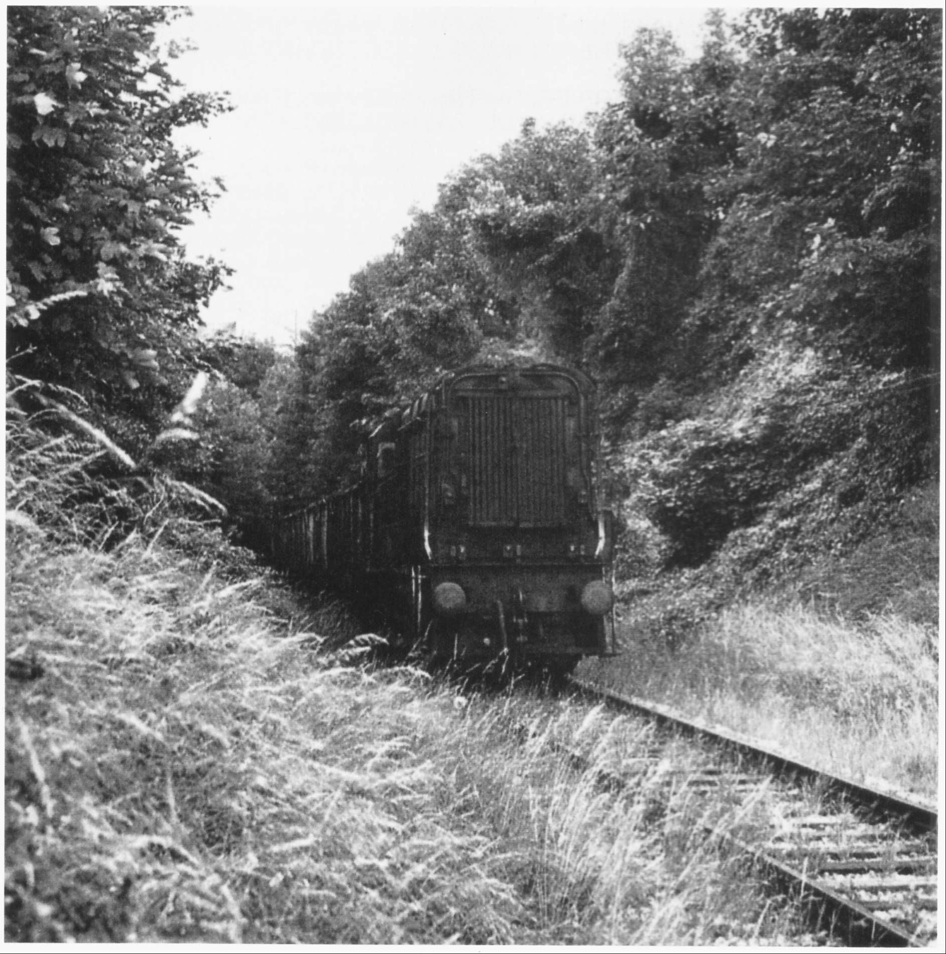
The line branched off from the Lewes bound line (see the photo and map below), just after the Ditchling Road tunnel.
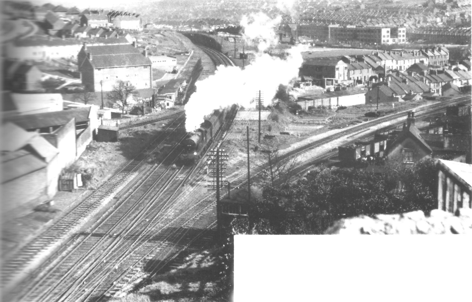
It
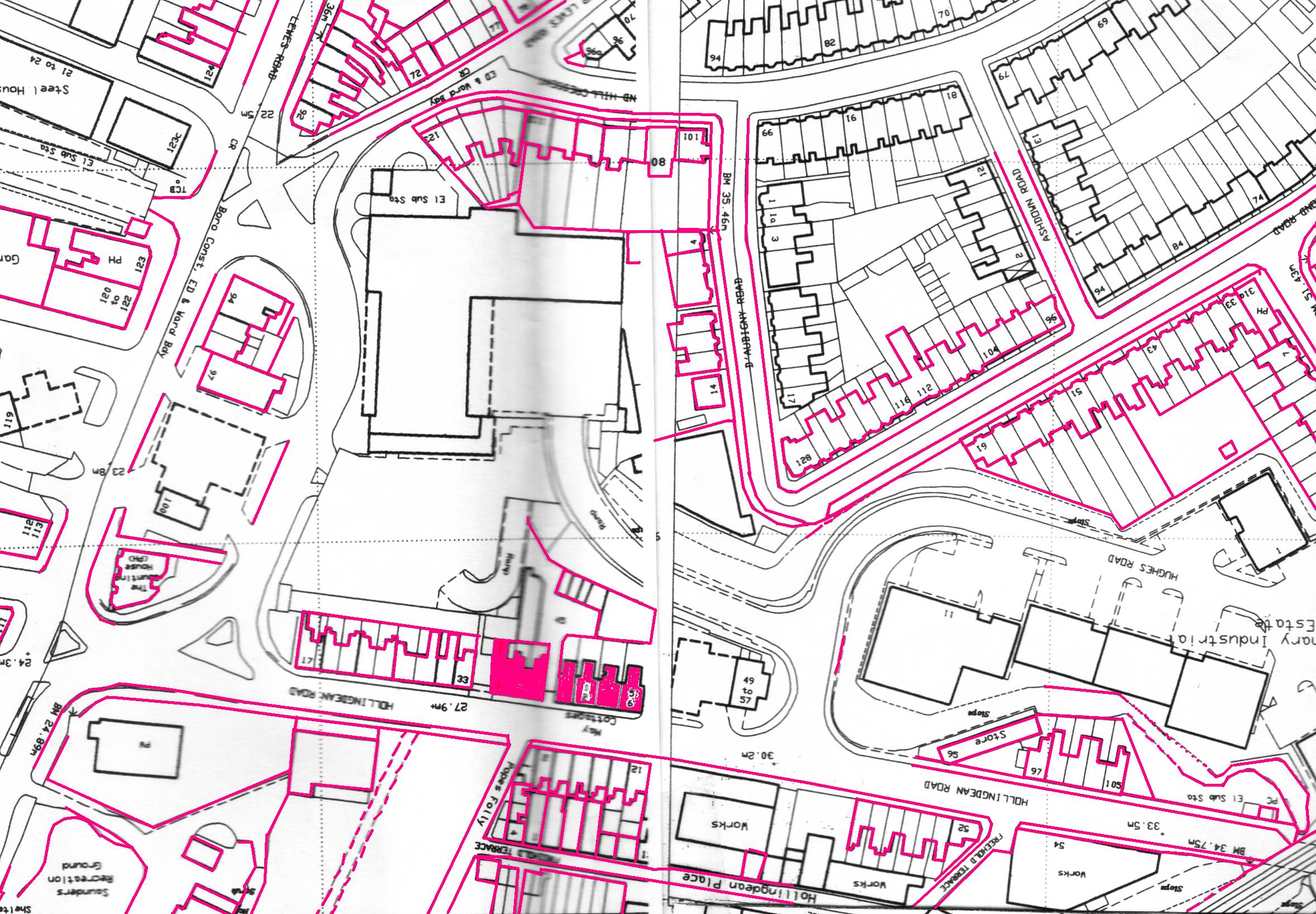
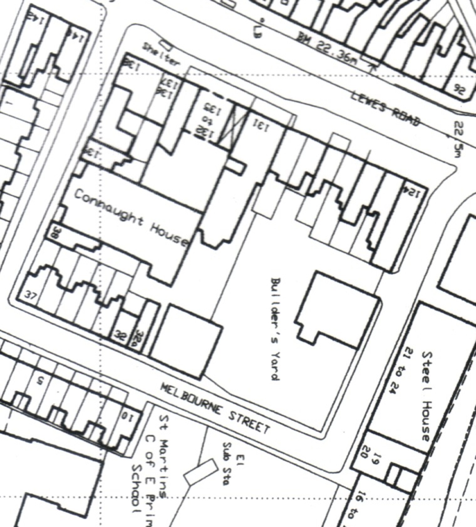
broke out into a series of coal sidings (next photo & maps), which were
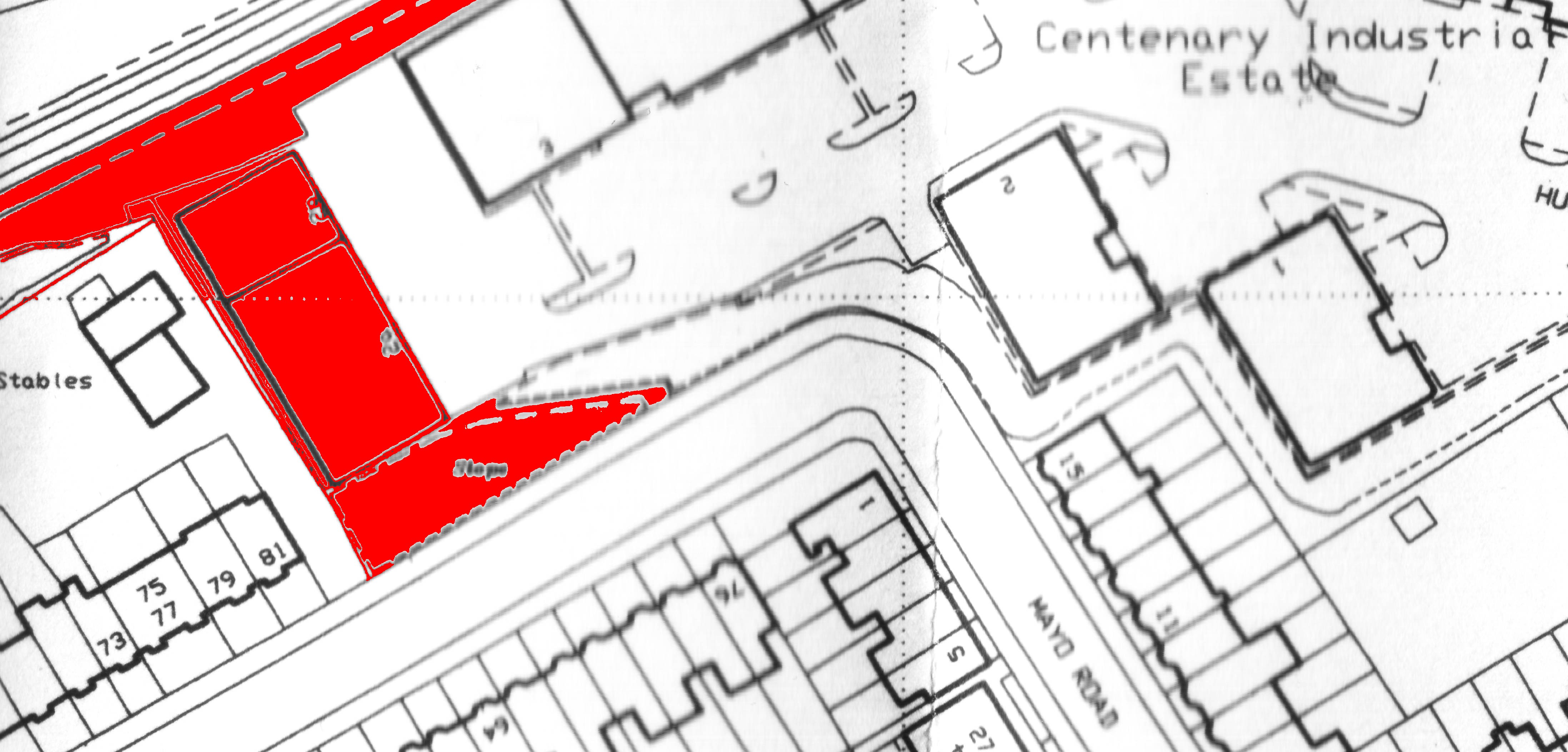
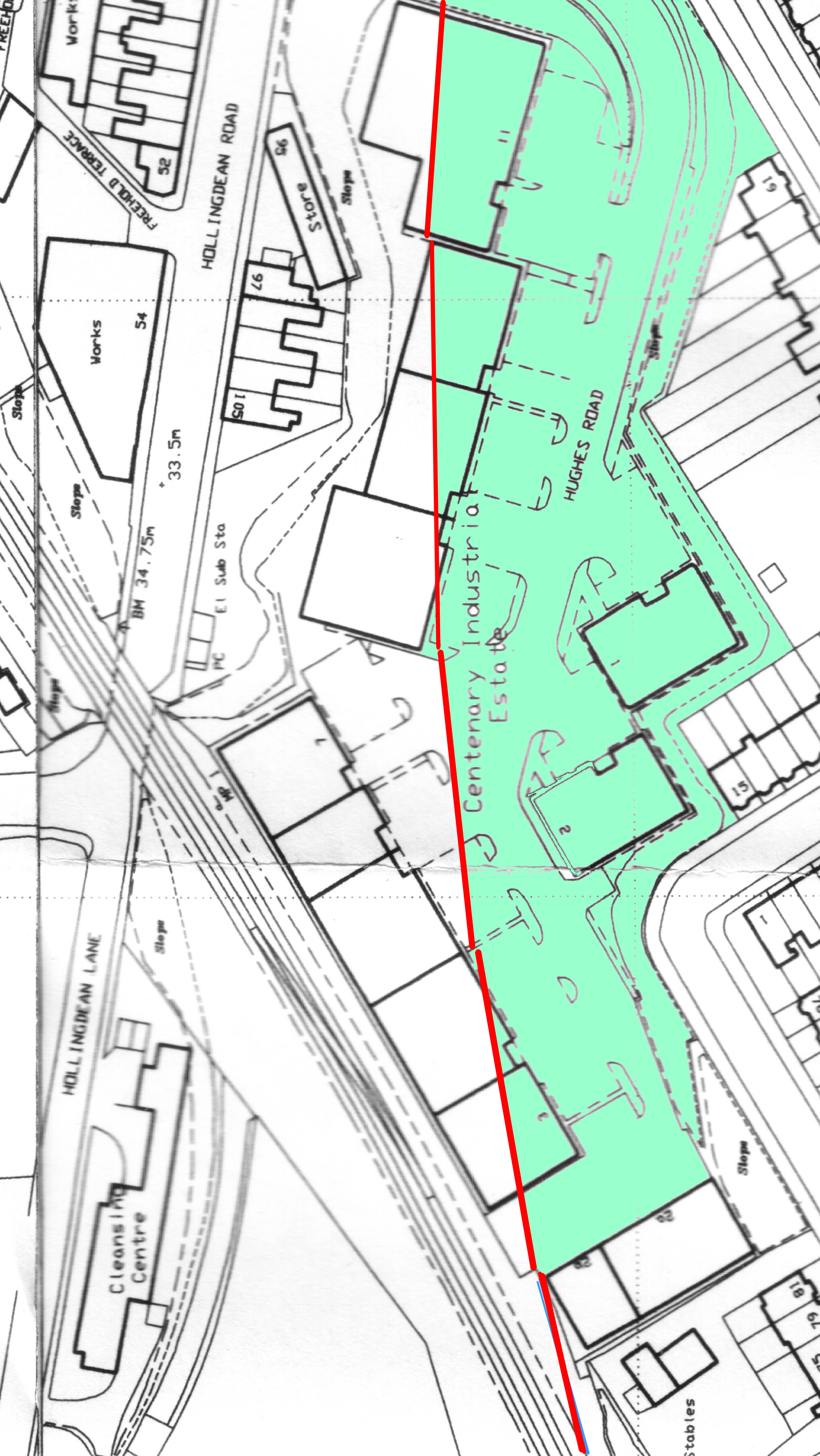
situated just below the junction of Mayo Road and Princes Road in the
area that is now occupied by Hughes Road and the Centenary industrial
estate.
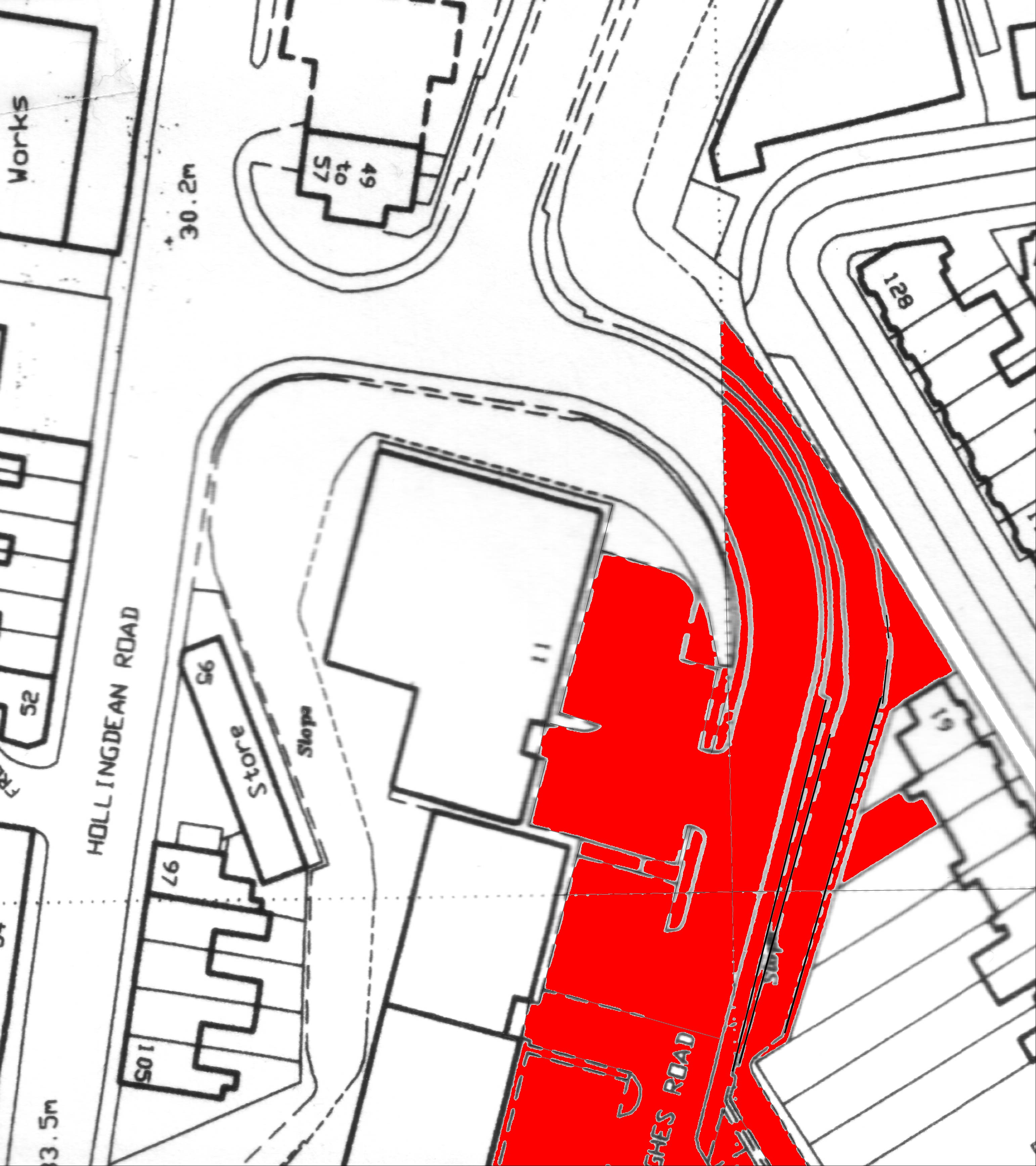
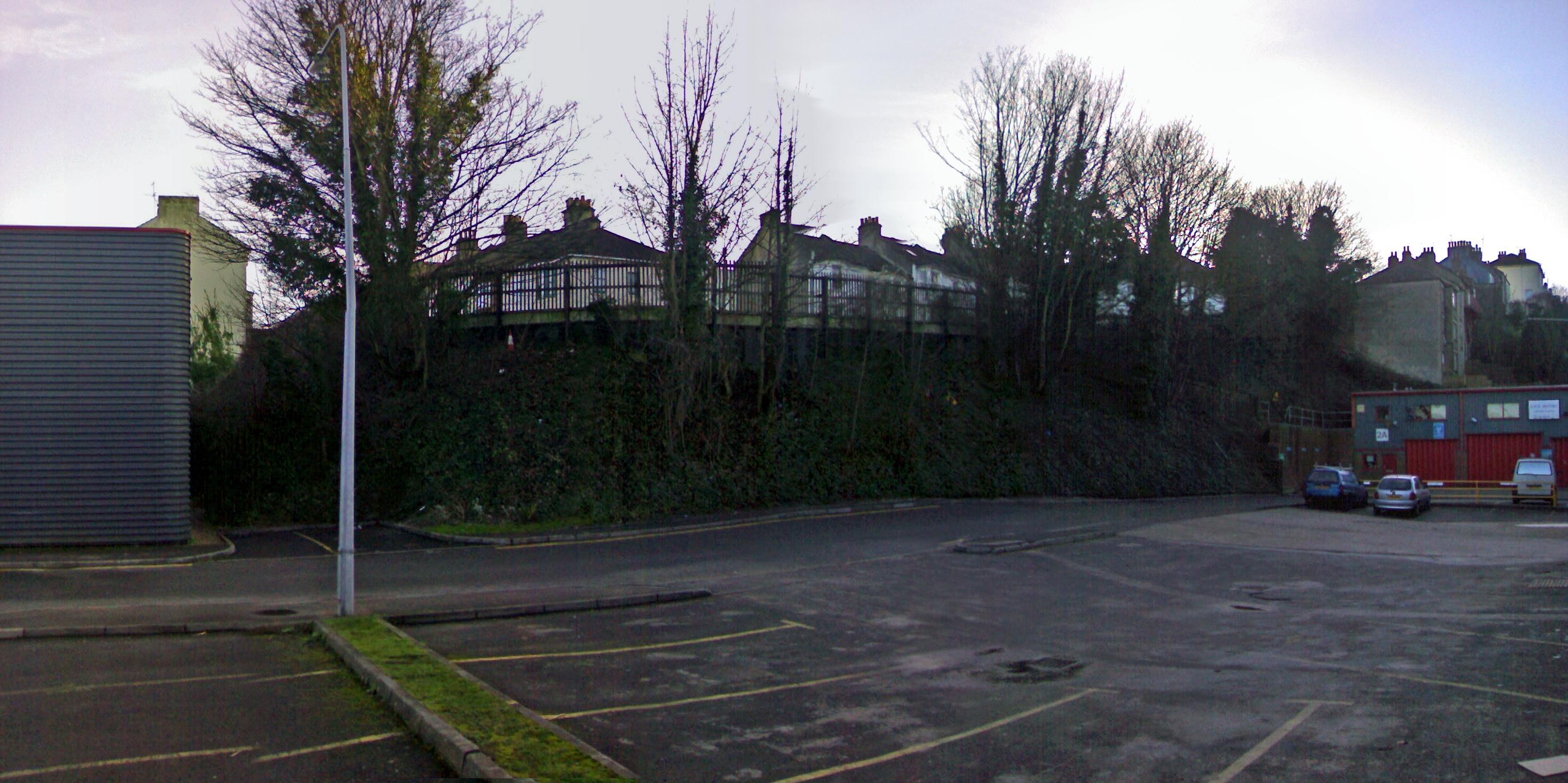
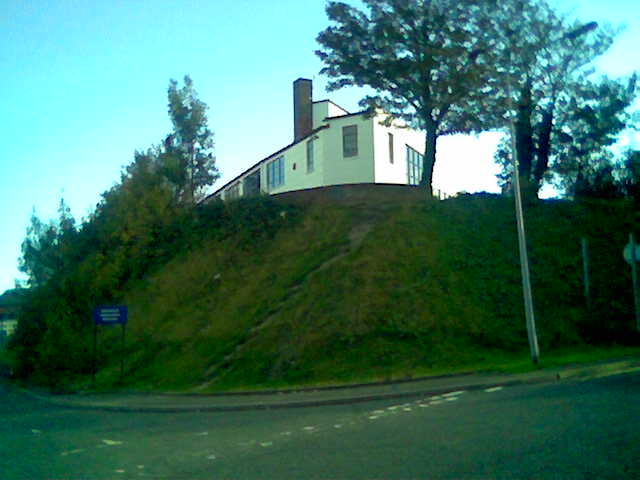
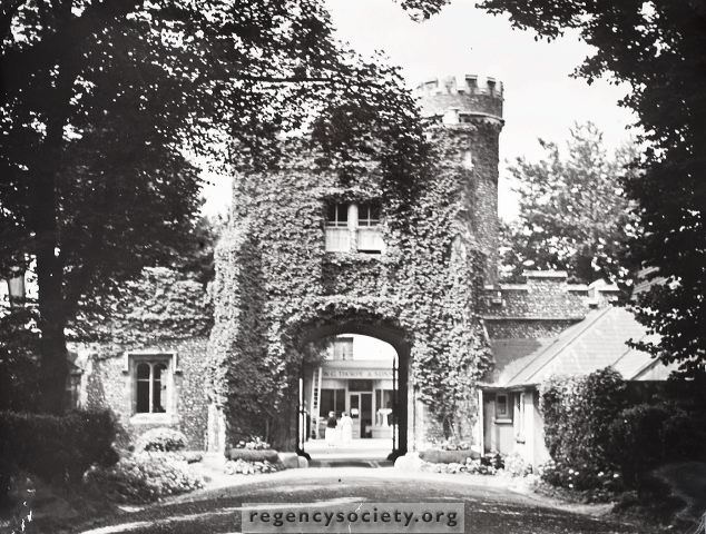
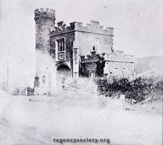
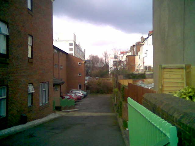
A signal box stood at the junction just before the first coal siding, on the site now occupied by unit 2b in the Centenary Estate (seen below).
![]()
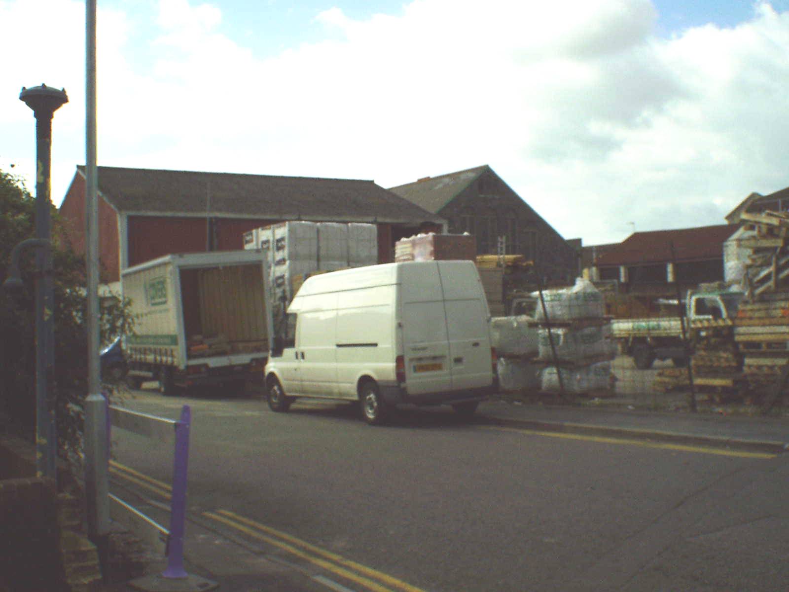
A
fair amount of the original earthworks remain as the Centenary estate
is built in & up the sides of a roughly ‘U’ shaped bowl (CLICK on
the icons shown below and scroll upward to see old and new maps and
find out what and where they show).

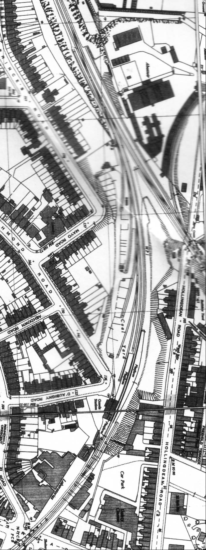
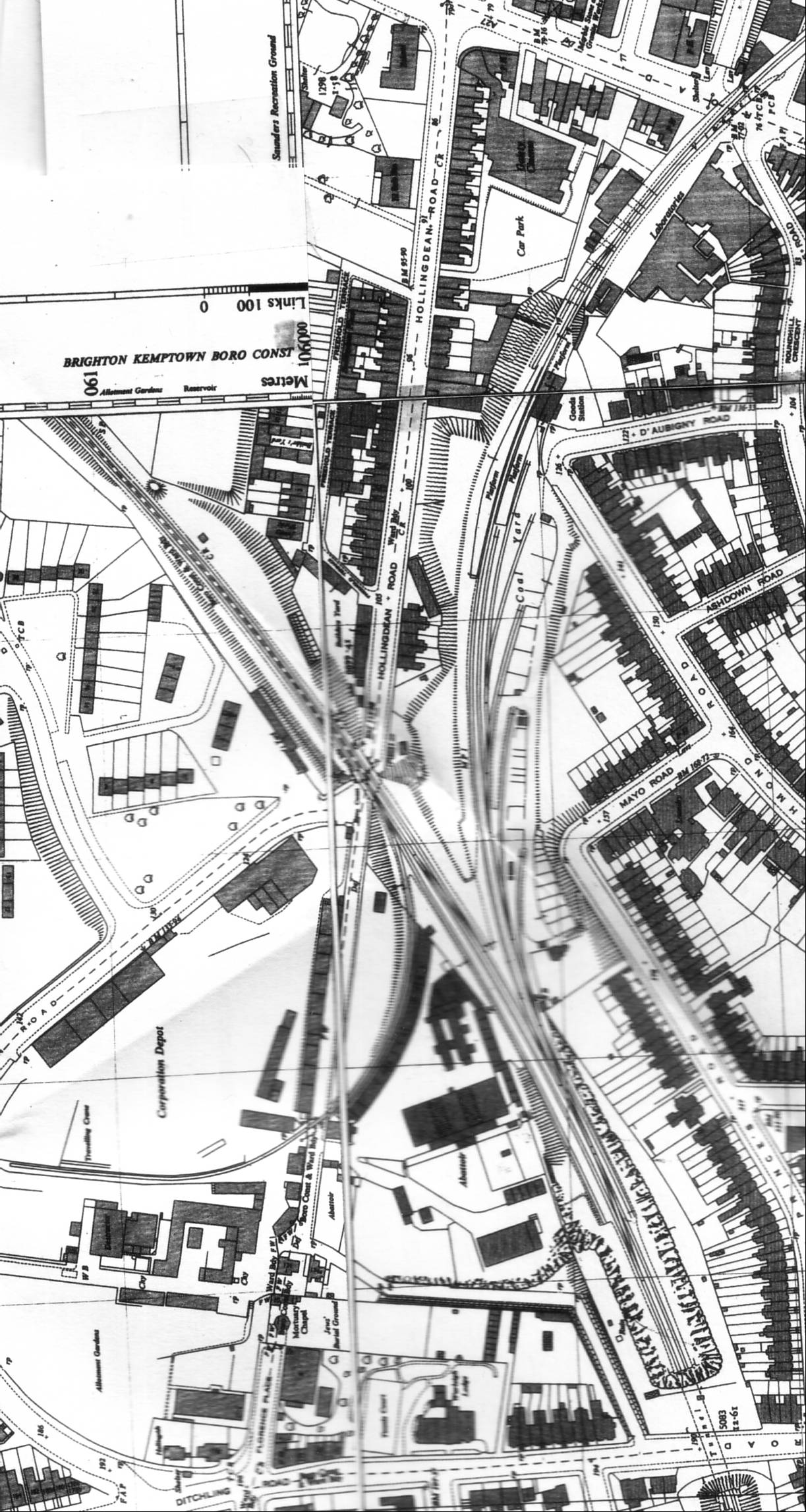
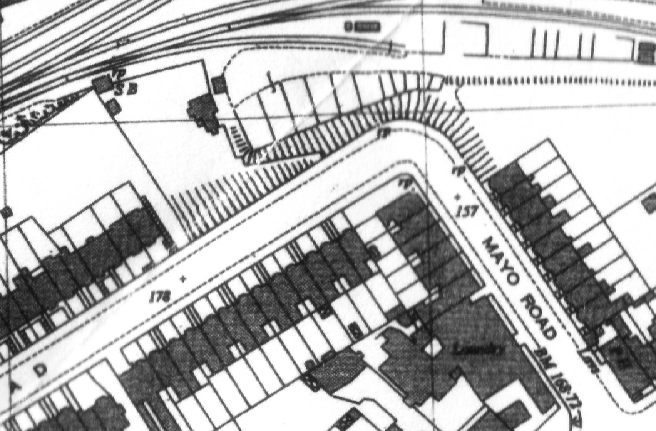
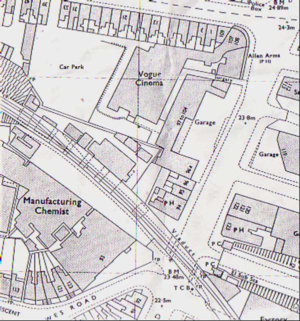
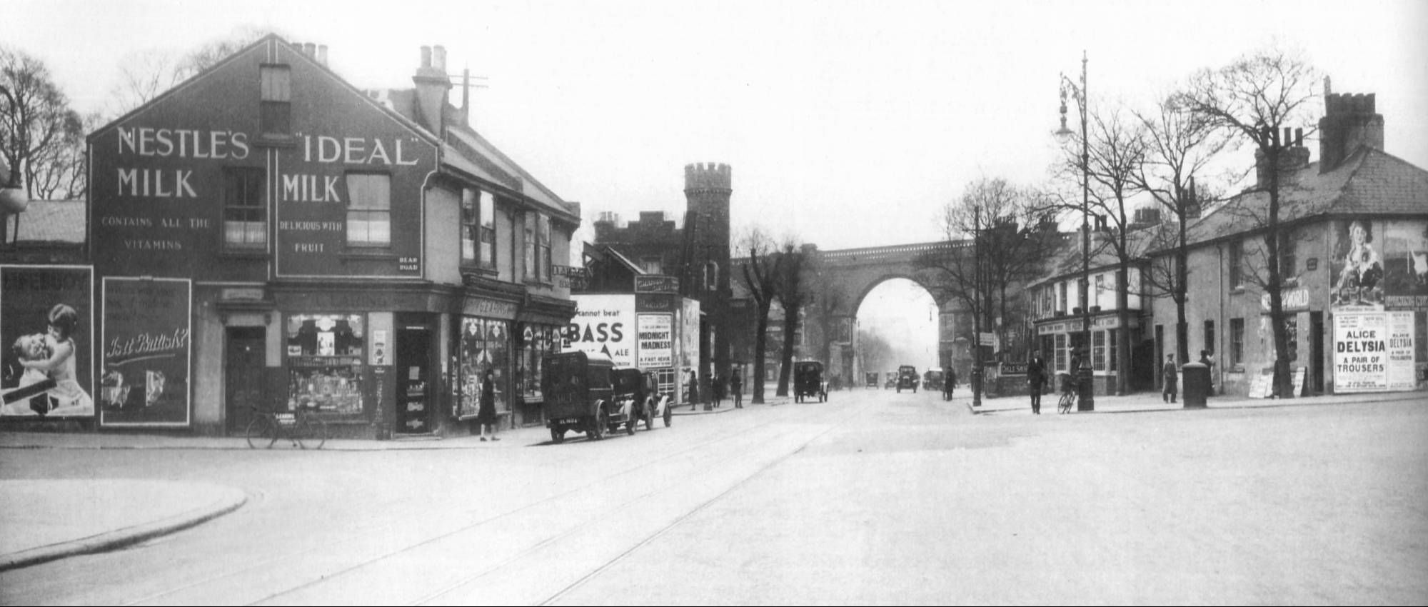
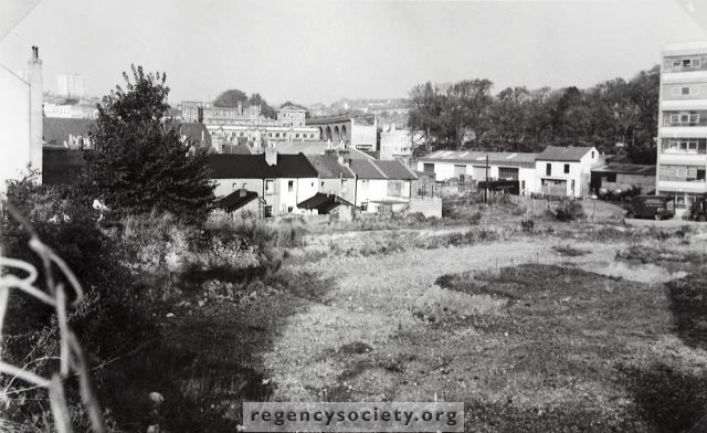
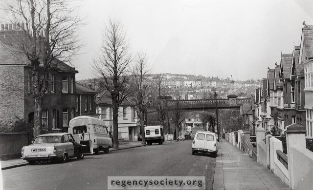
Lewes road station was sited at the elbow formed by the junction of Richmond and D’Aubigny Roads, along with a goods depot at the east end of the station, roughly where the Sainsburys goods ramp now joins Hughes road (CLICK the icons below, then scroll upward to see the map and photos of the station).
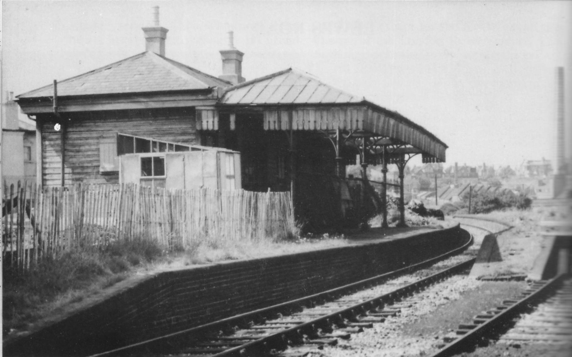
The Kemp town branch was double track between the junction and the end of the platforms, but was single track from this point all the way to Kemp town.
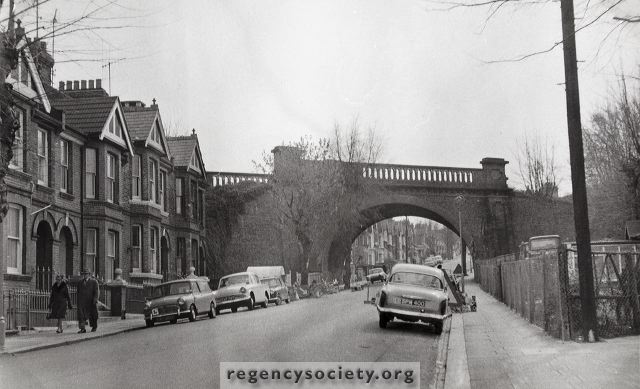
The
single line track then crosses the 28 arch viaduct over Lewes road. The
viaduct would have curved across the road starting out from a point
that is now occupied by the escalators just to the right of the brick
frontage of Sainsburys. (CLICK the icons and scroll upward to view
maps and pictures).

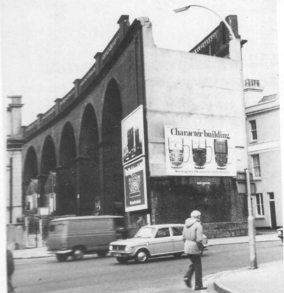


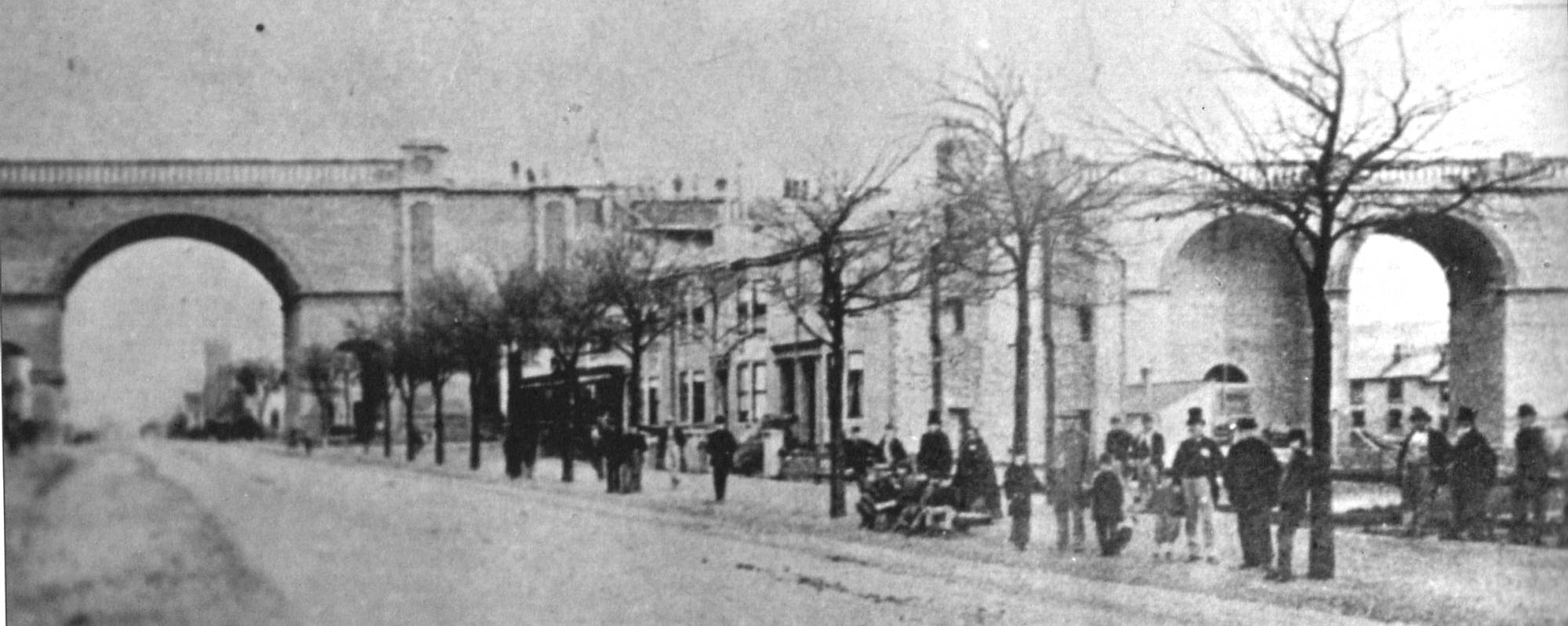
In
a recently discovered photo of the viaduct, I found an intriguing
building with a turret in one corner, which I have discovered was
Woodvale Lodge, the original wardens’ accommodation for the crematoria.
There is now a paved area, gates and mortuary in its place just to the
right of the Gladstone pub. While this building was not connected with
the railway, it was close to the route of the viaduct and, I feel, a
particularly interesting building (seen in the centre of the photo
below left, to the left of the arch of the viaduct. Also seen solely in the other photos alongside it).
There is a Quikfit building on the corner of Gladstone Place, which is curious, in that on closer inspection, it would appear that the building may be a lot older than the new signage portrays. There is a subtle hint of some very ornate columns at the frontage with Lewes Road. I believe that this building was originally a sawmill. A granite and stone workshop would have stood on the site of what is now the Budget car rental forecourt on the left of the entrance to Gladstone Place.
There were originally two public toilets at the entrance to the crematorium grounds, one on either side; the left hand one adjoining Woodvale Lodge. These would have been a very welcome site to Brightonians in the current climate of doing away with public toilets by the city council! A small tram shelter stood just outside the Gladstone pub opposite the conveniences, facing the lodge.
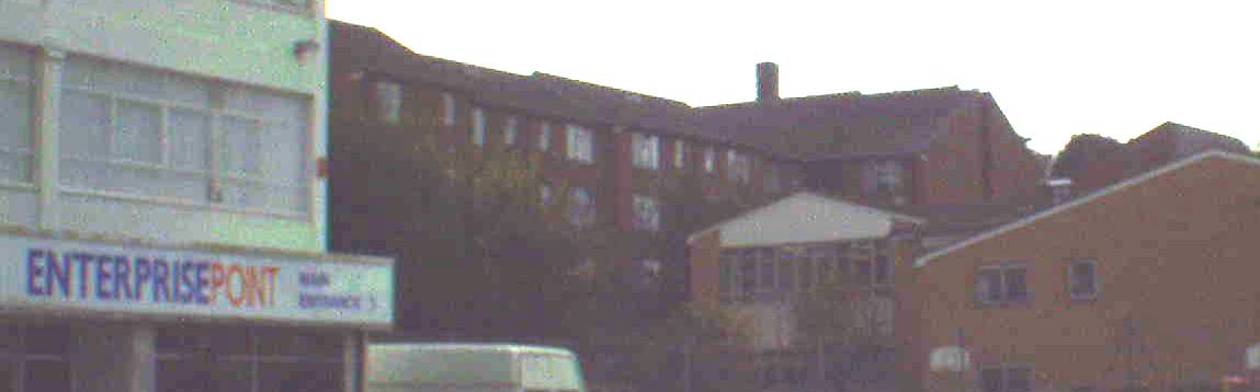
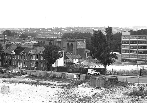
The viaduct would have traversed the area now bound by the yard of Covers Builders merchant, crossing through one corner of the square of Melbourne Street, before the end of the viaduct. This end of the viaduct would have butted onto an earth mound on the site of what is now Enterprise point and then through the grounds of St. Martin’s Primary School. (CLICK icons below and scroll upward to view pictures and maps)


At the other side of the mound would have been a single span bridge across Hartington Road, just before the junction with Shanklin road.
Hartington
Road had its own little station for a while in the form of a halt on
the west side of the track at the eastern side of the bridge. This was
a short wooden platform about the length of 2 coaches and operated as a
“hail and ride” station: that is you would have to flag the train down
in good time for it to stop. (CLICK icons below and scroll upward to
view maps and pictures).

There was a path leading down a small slope to Hartington Road, just to the east of the bridge which still survives today as the entrance to William Clark park as the site is now known. A small path also ran from the other end of the platform to the corner of the cul-de-sac of Upper Wellington Road, which was bound by the railway boundary at its eastern end. The Halt was in regular use from 1st January 1906 until its demise in April 1911.
The reason this station was so short-lived was due in part to the fact that it was never inspected or approved by the Board of Trade: they only found out about the existence of the halt when an article about it appeared in the December 1905 edition of The Times, relating to the LBSCR’s use of petrol railcars on the route.
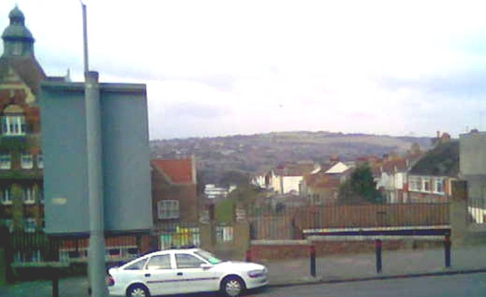
The railway line would then have entered a cutting, which backed onto houses in Bonchurch Road.
This area in recent years has been landscaped and is now William Clark Park. At the lower end of the park there are some conspicuous humps and banks, which indicate the start of the embankment then cutting at this end of the bridge over Hartington Road.
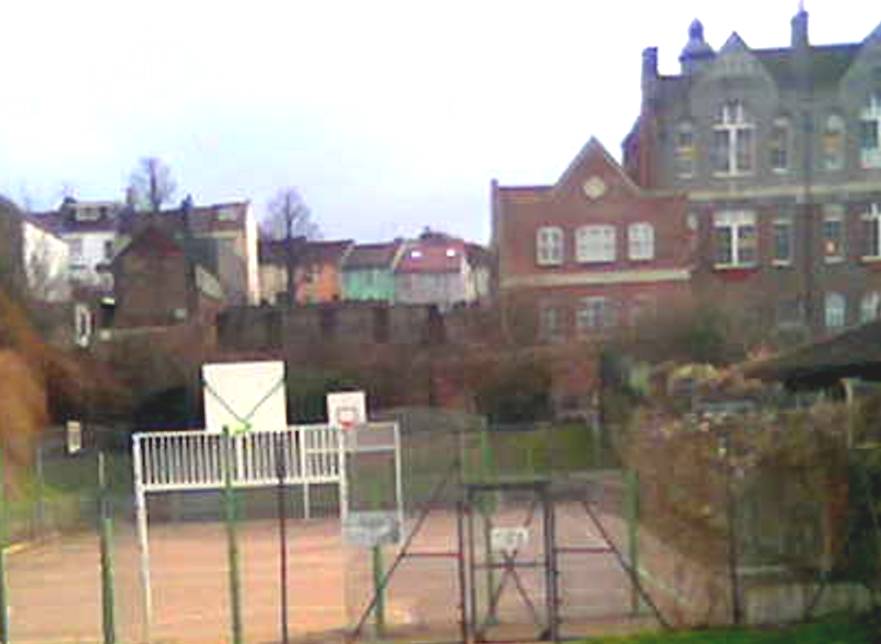
The
cutting ran almost to the length of Bonchurch Road and ran into a
tunnel portal just in front of what is now the tennis courts and
playground next to the school in Elm Grove. This stands opposite
Bentham Road and, principally, Carlyle Street. (CLICK icons below and
scroll upward to view pictures).
I have heard from a colleague who used to work on the line that this was particularly popular with the school children at the time, who frequently used to return to class covered in soot and sinders in the wake of a passing train!
My family lived at 43 Carlyle street from 1972 until I was about 7 years old (1980) and I always remember being fascinated by stories my dad used to tell me about a secret railway which used to run under our house. He used to kid me that if I were to put my ear to the floor, that I would be able to hear the occasional train go past us deep underground. In reality dad was absolutely right about the tunnel going directly under the house, it passed through the boundaries of the back gardens of the houses between Carlyle Street and Arnold Street. Sadly for the romance of the stories, the last train ran through the tunnel in 1971, a frustratingly short two years before I was born!
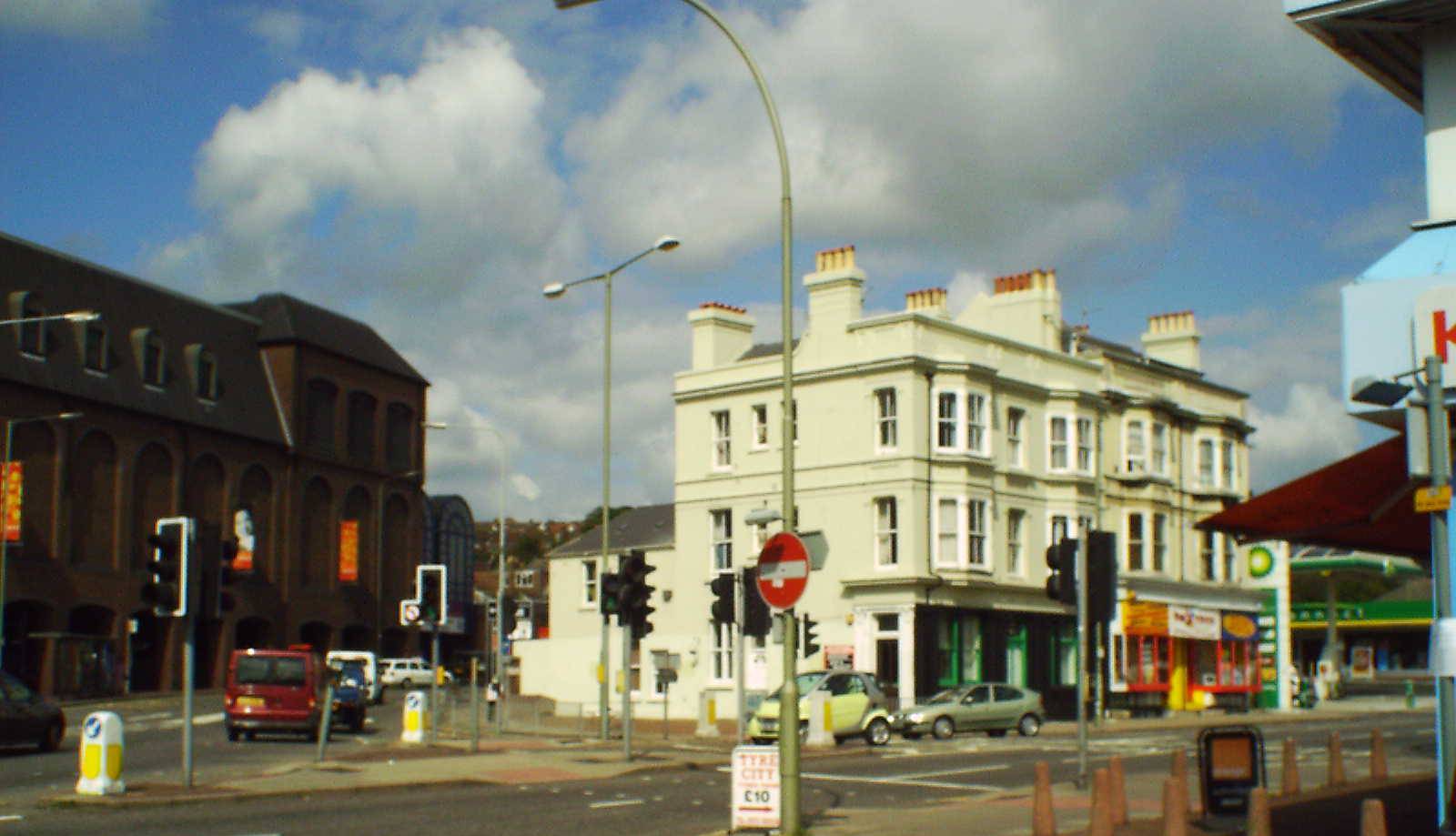
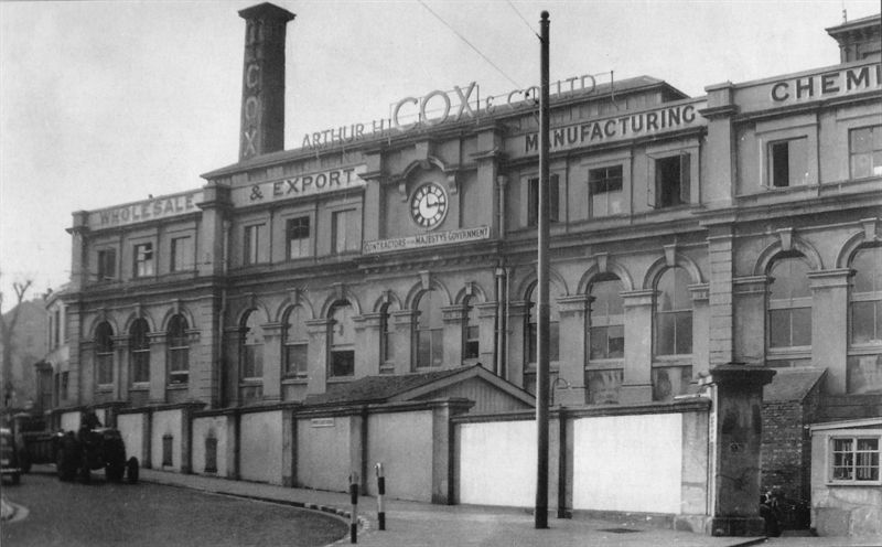
Looking at the architecture around Sainsburys and Hughes Road in the present day, there is very little to hint at what once stood there. The Sainsburys building has a lot of arches in its façade which hint at the arches of the viaduct and possibly of the Cox’s Pharmaceutical Company Factory building which originally stood directly on the same site.
It is a little known fact that the clock, which was originally a central feature of the Cox’s façade, has been built into the left-hand corner tower of the Sainsburys building frontage.
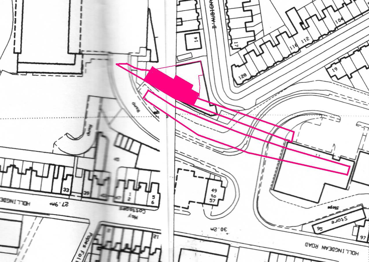
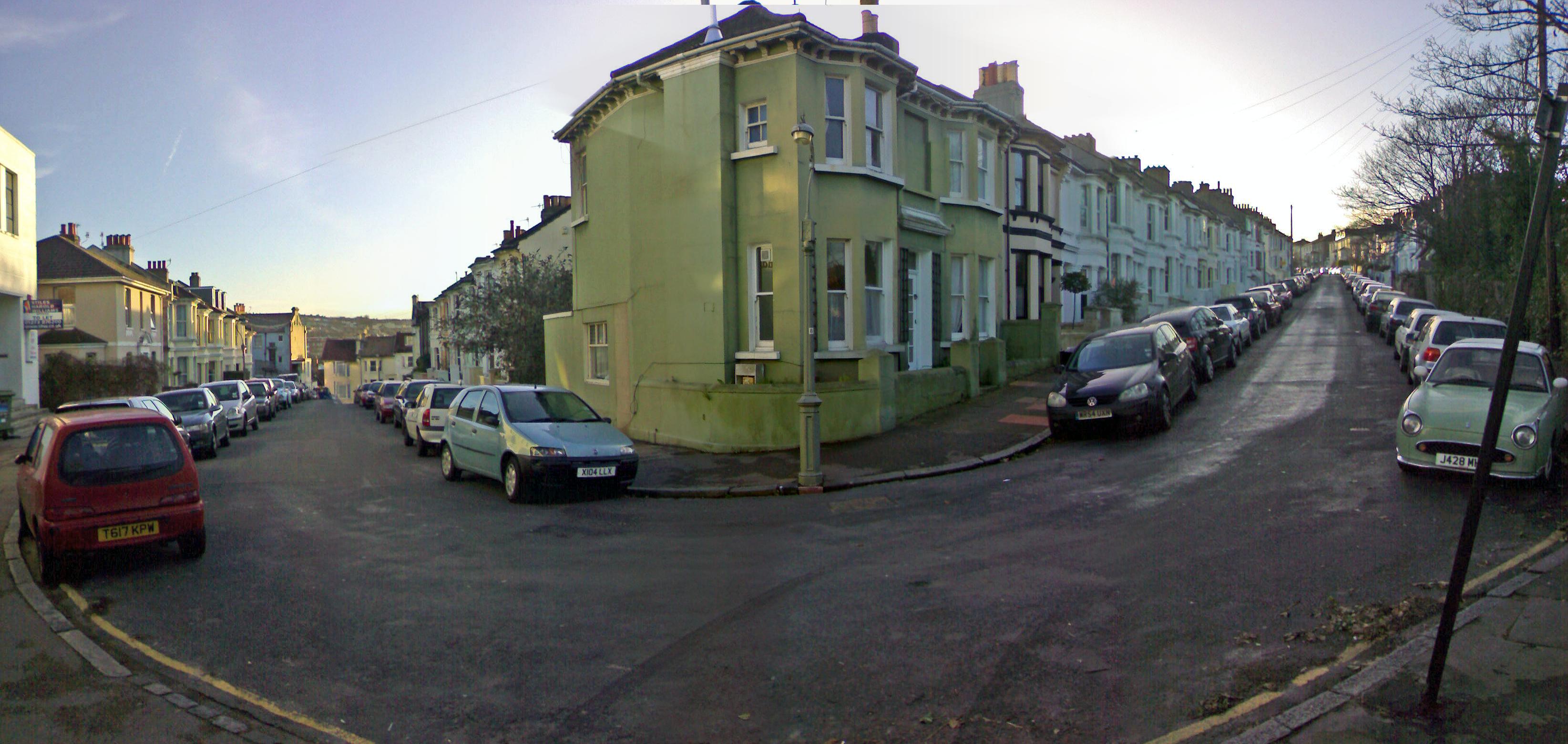
The Vogue Gyratory system constructed in 1985 at the junction of Lewes and Upper Lewes Road stands in the area where the viaduct was. The only real clue that remains of Lewes Road station may be seen when walking up the steep gradient of Richmond Road, which has railway style fencing where it joins into D’Aubigny Road. This corner would originally have been the forecourt of Lewes Road Station and would have been on the same level.
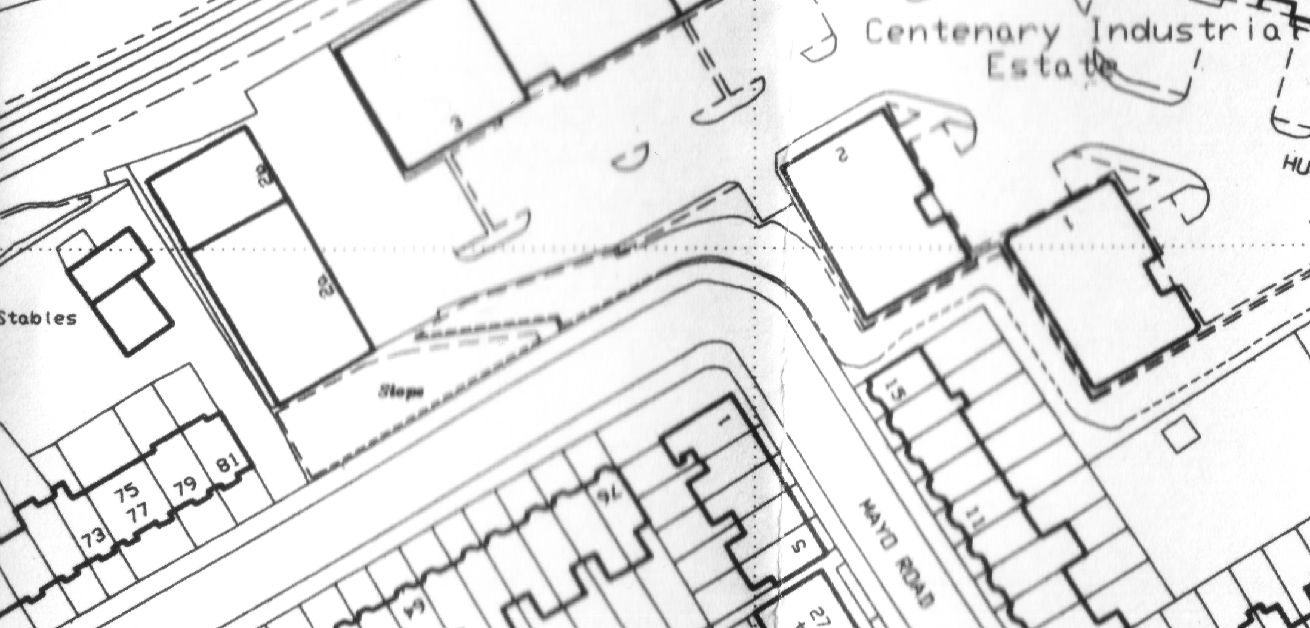
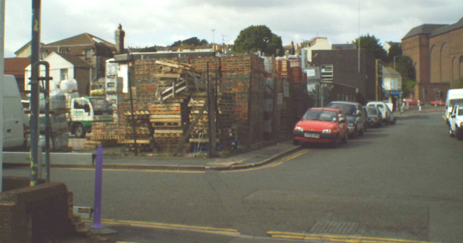
At the apex of the corner of Mayo Road and Prince’s Road, a concrete wall has been constructed at the top of the steep bank facing Hughes road at its base. If one were to look carefully they would notice the original brick paving to either side of the granite paving slabs, which make up the corner now.
The bank has been cut back to accommodate the factory units below, but would originally have had 4 short sidings with coal stathes at its base along with a slope either side of it. The western slope would have had a small stable on it along with a small field or uncultivated area. This has since been removed and replaced with a vertical embankment to the factory units below (see next picture).